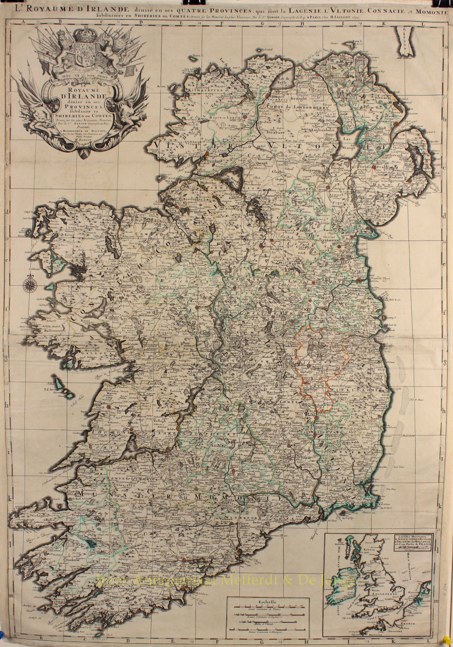
SPECTACULAR MAP OF IRELAND "Le Royaume d'Irlande divisé en ses Provinces, subdivisé en Shireries ou Comtes", copper engraved map of Ireland made by Alexis-Hubert Jaillot in 1693, published in various editions of the Atlas Nouveau. With some original colouring. Two sheets joined, size: 90,5 x 62 cm. One of the best large format maps of Ireland issued in the 18th Century. Filled with details, showing towns, roads and trails, lakes and watershed, counties, and much more. Stunning large cartouche at upper left, with coat-of-arms of King William III, lion, unicorn and other embellishments. At the bottom right is an inset map of Ireland, England, The Netherlands and the channel coast of France. The map is based on Nicolas Sanson's earlier map, which Jaillot had redrawn on a larger scale at the request of Sanson's heirs. Price: Euro750,-